This blog features some of the author's lengthy essays on sacred scriptures, theology and history.

Tuesday, October 26, 2021


A HISTORY OF

THE DIOCESE OF BORONGAN, 1585-2021

This essay is dedicated to Bp. Godofredo Pedernal, a saintly bishop

by Lope C. Robredillo, SThD


The Beginnings of the Evangelization of Ibabao. Though the Estehanons’ first recorded encounter with Christianity occurred on March 18, 1521 when Magellan’s expedition reached Homonhon island, the historical beginnings of the Diocese of Borongan may be traced to as far back as 1585 when Augustinians set foot on Ibabao or Eastern Samar, but especially 1595 when Jesuits from Dagami, Leyte, systematically preached the gospel to the natives of the southern part of the island.  The people in the eastern littorals, on the other hand, were evangelized by Jesuits from Catubig and, later, Palapag as early as 1601. 

The Jesuit Missionaries. In spreading the Christian religion, the Spanish missionaries initiated the reduccion of the population and founded towns, educated the inhabitants in the faith, raised stone churches, taught settled agriculture, and protected the faithful from Muslim raids.  The major bungtos at that time were Bacod (now part of Dolores river bed), Jubasan (now Giboangan, Can-avid), Sulat, Libas, Borongan, Guiuan and Balangiga.  On the whole, there was no stiff opposition to the reception of Catholic faith.  After half a century, however, the mission suffered a major setback in the Sumuroy rebellion in 1649.

The Augustinian and Franciscan Friars. When the Jesuits moved out in 1768, the Franciscans took over the parishes that the former had created save for Guiuan and Balangiga which were briefly administered by the Augustinians.  The major problems that they faced were largely the same: population dispersion, Muslim raids and cholera epidemics.  They founded the parishes of Lanang [Llorente] (1851), Balangiga (1854), Sudao [Salcedo] (1862), Oras (1863), Libas (1863), Nag-as [Hernani] (1864), Paric [Dolores] (1878), and Quinapondan (1894). These parishes, together with those founded by the Jesuits, all twelve of them, constituted the Vicariate of the Eastern Coast of Samar, under the Diocese of Cebu.  In terms of orthodoxy, however, they found a big challenge in the influential but heretical teachings of Don Gaspar de Guerrero.  He had a number of followers in several towns who held heretical beliefs and were engaged in unorthodox practices.  It may be remarked that during this period, some Samareño priests already held parishes as pastors.

Under the Americans and Pulajanes. However, the Spanish-American war in 1899 shook the Franciscan ministry and the local Church on Samar as a whole, what with the anticlericalism and Aglipayanism of Gen Vicente Lukban who had presented himself as Aguinaldo’s appointed Governor of Samar.  In fact, the Spanish friars resigned from their posts.  But at the same time, many people, including a number of Filipino priests, suffered from American ill-treatment.  Bucolic life was disrupted; hundreds of Samareños were killed.  Though Lukban was captured in 1902, peace never reigned; in the fierce war of the Philippine scouts with the local freedom-fighters, the Pulajanes, the latter practically controlled the island until 1905, leaving much suffering in its wake.  As a consequence, there was dearth of priests, between 1899 to 1905, to serve the needs of Samareños. 

Ibabao Under Calbayog Diocese. On April 10, 1910, the Estehanons became part of the Diocese of Calbayog, when the island of Samar was separated from the Diocese of Cebu.  Protestantism, American education system, and American culture became a challenge. Several Franciscans returned to work in the parishes.  Partly to counteract the spread of Protestantism, a Catholic school was established in Guiuan in 1927, as was done in other towns of the island.  Other schools followed, eventually placed under the management of or established by the RVM sisters (Assumption College of Samar [Guiuan], 1940; St Joseph’s College [Borongan], 1946; Holy Cross Institute [Oras], 1947; Our Lady of Fatima Academy [Gen. MacArthur], 1949; and St Anthony’s Academy [Llorente], 1949; Loyola Academy [Sulat] 1958 reverted to Msgr Desoloc). During World War II, which displaced, decimated and impoverished the Estehanons, some priests aided Filipino guerillas.  After the war, the following parishes on the eastern part of the island were created, now all under Filipino priests: San Ramon [Arteche] (1955), Giporlos (1955), Maydolong (1956), Can-avid (1956), Sulangan (1957), Pambujan [Gen. MacArthur] (1958), Matarinao-Burac (1959) and San Policarpo (1959).  Catechesis in elementary school was engaged in by almost all parishes.  In 1957, A lone Italian missionary (FdCC) started working in the parish of Jipapad.

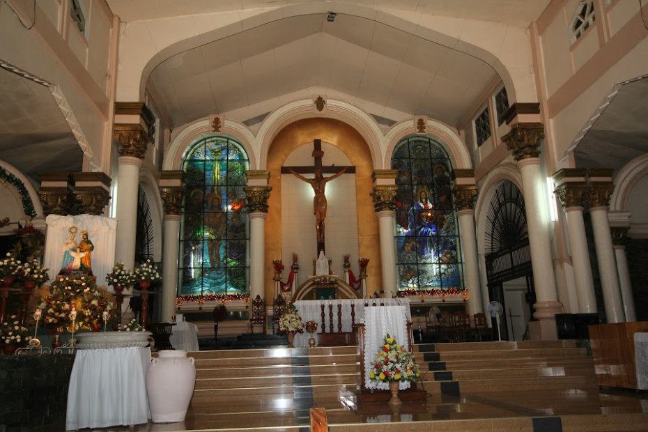
The Birth of the Diocese of Borongan. On October 22, 1960, Pope John XIII issued the apostolic bull, Quod sacri, creating the Diocese of Borongan (Dioecesis Boronganensis), which originally included the aforementioned parishes as well as the parishes of Gamay, Basey, Calbiga, Pinabacdao, Villareal, Osmeña, Talolora and Sta Rita.  The Pope appointed as its first bishop Bp Vicente P Reyes, DD, auxiliary bishop of Manila, who was installed on April 11, 1961.  In keeping with the executory decree on the erection of the diocese, the construction of the Borongan Cathedral and the minor seminary, Seminario de Jesus Nazareno, which was formally inaugurated in 1965, became priority infrastructural projects.  

Partly to halt the inroads of Protestantism in parishes, and in compliance with the First Plenary Council of the Philippines in 1953, diocesan schools, managed by diocesan priests, were also established: Jesus Nazareno Academy (Maydolong) 1962; Divine Child Academy (Lawaan) 1962; Borongan Cathedral School 1965, and Guimbaolibot Memorial School 1965.  Apart from Lapinig in Northern Samar, erected were the parishes of San Buenaventura [Balangkayan] (1961), Lawaan (1961), Mercedes (1964) and Lalawigan (1964).  The faith was sustained among others by the strengthening of the cofradias (San Antonio, Lourdes, Children of Mary, Apostolados, San Jose, Holy Name, etc.) and such Catholic organizations as the Catholic Women’s League (CWL), Knights of Columbus (KC) and the Legion of Mary which had 12 Curiae and 105 Praesidia, all of them under the umbrella of a very active Catholic Action, which was the participation of the laity in the apostolate of the bishop and his priests.

Impact of Vatican II. With the closing of the Second Vatican Council, the Diocese moved toward the implementation of some conciliar decrees. In 1962, the Cursillo de Cristianidad became popular in the renewal of Christian faith and life, but the movement that penetrated the common people both in the poblaciones and the barrios was the Barangay han Birhen.  To involve the laity not only in the apostolate but in governance, pastoral councils were organized in all the parishes as early as 1961. In the wake of the National Rural Congress in 1967 that promoted awareness of the socio-economic problems of the people, the Diocese saw non-conflictual development as one of its thrusts.  With the assistance of the Knights of Columbus, cooperatives and credit unions sprung up in the Diocese in 1969, and the rural banks in Guiuan, Borongan, Oras, Dolores and Giporlos were established.  A corn mill was even put up in Dolores to help farmers. Meanwhile, a new, concrete bishop’s residence located near the Cathedral began to rise in 1968, replacing the old wooden residence in Sitio Libertad (Taboc), Borongan. 

The Period of Martial Law. It was in the 1970s until the early 80s that the faithful in the Diocese, including the clergy, were confronted with the problems spawned by Martial Law: deterioration of peace and order, human rights abuses, displacement and evacuation of inhabitants, among others.  People were caught up in the crossfire between the Philippine Army (PA) and the New People’s Army (NPA), with many untold and unhappy consequences. In the 80s, population declined in some areas.  The clergy tried to respond concretely to these problems.  The diocesan thrust, following the response of the Philippine Church, was development and liberation. Developmental projects were pursued, especially for farmers and fisher folk.  It was in line with this thrust that An Tiklos, a mimeographed diocesan paper, was born.  On December 5, 1974, the Diocese became confined to the civil province of Eastern Samar, when the parishes of Gamay and Lapinig were ceded to the new diocese of Catarman. Only one parish was added in the 70s: Homonhon (1979).

The Involvement of the Laity. Late Martial Law period (1980s) and onward saw the rise and growth of movements that sustained and deepened the Catholic faith—Charismatics under various brands (Community of the Risen Lord, Faithful Followers of Jesus Christ, Lamb of God Community, etc.), Neo-Catechumenate, Marriage Encounter (ME), Oasis of Love, El Shaddai, Light of Jesus, Chrisma, Brotherhood of Christian Businessmen and Professionals (BCBP), Mother Butler’s Guild, and the Couples for Christ family (CFC), the last one having branched out to all the parishes and large barangays.  They appeared to have put a break to the spread of Fundamentalism and Pentecostalism. 

To allow the formal participation of the laity in the liturgy, especially in the celebration of Sunday liturgy in the absence of a priest in the barrios, lay ministries were introduced and flourished, starting in 1993.  In 1991, DYVW, the only Catholic radio station in the province, started a new media ministry.  New parishes were born during this period: Maslog (Quasi-Parish, 1982), Buenavista (1999), Sapao (2004), Maypangdan (2005), Hinolaso (Quasi-Parish, 2006), Buabua (Quasi-Parish, 2006) and Sabang, Borongan (in process).  To form seminarians in the local context, the Nativity of our Lady College Seminary was established in 1996. 

The Coming of Religious Communities. Several religious congregations, each with its own apostolate, enriched the pastoral ministry: Missionaries of the Sacred Heart (MSH) in 1987, Sister Servants of the Visitation (SSV) in 1988, Society of Don Bosco (SDB) in 1991, Franciscan Sisters of the Sacred Heart (SFSC) in 1995 in Dolores, Daughters of Charity (DC) in 1995-2005, Order of Friars Minor Conventual (OFMConv) in 1997, Oikos Ptochos Tou Theou (OPT) in 1998, Sisters of the Presentation of Mary (PM) in 2010, the Living the Gospel Community (LGC) in 2010, Poor Claire Sisters (OSC), Sisters of Jesus the Good Shepherd or Pastorelle Sisters (SJBP) in 2016, and Franciscan Missionaries of Mary (FMM).    

Agents of Evangelization. Partners in formation in the faith are 2 colleges (St Mary’s College of Borongan and Mater Divinae Gratiae in Dolores) and 9 high schools, mostly run by religious sisters, a good number of pre-schools, and 1 technical school. In line with Catholic faith formation and in response to the call of the New Evangelization, established in 2010 was the “Voice of the Word” Media Network (VWMN), the media arm of the Diocese, which now runs DYVW-AM, DYVW-FM, online radio, VWTV, VWMN FB & YouTube Channels. Eastern Samar News Service and Este newspaper.

The First Diocesan Synod of Borongan. In keeping with the recommendations of the Second Plenary Council of the Philippines (PCP II), the Borongan Diocese, after a two-year preparation, held its greatest ecclesial event: the First Diocesan Synod (1997), defining its life and mission in the present and coming years, and providing basis for its pastoral plan. Its diocesan pastoral plan was formulated in 2004, almost decade after the synod, supposedly to culminate in the golden anniversary of the diocese, but it has yet to see its implementation phase.  Its major pastoral thrust, however, as enshrined in the first synod and in the pastoral plan, was the formation of Basic Ecclesial Communities (BECs).  The Daughters of Charity (DC) handled the program for 10 years (1995-2005), and several other communities sprouted in various parishes after they left.  

Toward a New Financial System. In line with its mind to give new direction to the life and mission, the Diocese systematically implemented the New Financial System (NFS) in 2015 based on the spirituality of stewardship.  It might be of interest to recall that, historically, the first parish to initiate a system that dispensed with arancel in its program of maintenance was Lalawigan when, in 1961, each family contributed a nominal sum every month for the needs of the pastor and the parish apostolate.  In conformity with the decrees of the 1997 synod, however, several parishes likewise instituted a modified tithing system, a more proportionate system that reflected the call for Church renewal by the diocesan synod.

Services to the Poor. The underprivileged have been the destinataire of its social mission.  In the immediate past, it may be recalled that the Diocese started several social programs to help the poor, like the now defunct Emergency Livelihood and Assistance Program (ELAP) in 1991, and those handled by the Social Action Center, like Small Enterprises and Kapital Assistance Program (SEKAP) in 1995, Community Health Base Program (CHBP), involvement in the election process, anti-mining advocacies, not to mention other services (orphanage, home for the aged, clinics, home for children of the poor).  At present, through the Commission on Social Action, Justice and Peace, the Diocese carries on such other projects as Bulig Kablas Medical Mission, Botika sa Parokya and Disaster Response Program aimed at social change through value formation and people empowerment.  But its biggest social program for the poor was undertaken in the aftermath of Yolanda (Haiyan) super-typhoon in 2013 when, largely through the assistance and partnership with major donors, it brought about substantial services to the affected parishes south of the diocese.

Services to Its Own Clergy. On the other hand, as a service to its own ordained workers, the Diocese established its own medicare program (1984), local pension program for the elderly priests (2007), and a priests’ home (2010).  

The Ordinaries Who Governed the Diocese. In its 60-year history, the Diocese of Borongan was governed by nine Ordinaries: (1) Bp Vicente Reyes, DD, 1st bishop of Borongan (1960-1967), his Vicars General being Msgr Simeon Desoloc (1961-1966) and Msgr Angel Hobayan (1966-1967); (2) Msgr Hobayan, JCD, Vicar Capitular (1967-1968), (3) Bp Godofredo Pedernal, DD, 2nd bishop (1968-1976), his Vicars General being Msgr Angel Hobayan (1968-1969), Msgr Conrado Balagapo (1969-1971); Msgr Desoloc (1971-1973), Msgr Hobayan (1973-1974); Msgr Desoloc (1974-1976) with Fr Exequiel Singzon as Pro-Vicar General (1974-1976); (4) Bp Ricardo Tancinco, DD, Apostolic Administrator (1976-1977), (5) Bp Sincero Lucero, DD, 3rd bishop (1977-1980), his Vicar General being Msgr Emiliano Balein (1977-1978); (6) Bp Nestor Carino, DD, 4th bishop (1980-1987), his Vicar Generals being Msgr Conrado Balagapo (1980-1985) and Msgr Alfredo Amistoso (1985-1987); Bp Carino resigned in 1986, but he was appointed Apostolic Administrator until the arrival of his successor; (7) Bp Leonardo Medroso, DD, 5th bishop (1987-2006), his Vicars General being Msgr Crescente Japzon (1987-2001) and Msgr Lope Robredillo (2001-2006); (8) Msgr Robredillo, SThD, Diocesan Administrator (2006-2007), and (9) Bp Crispin Varquez, DD, 6th bishop (2007-to date), with Msgr Robredillo as Vicar General (2007-to date). 

Current Status. As of 2018, out of the 490,645 inhabitants of the province, the Diocese has about 475,011 or 96.3% Catholics, who populate the 34 parishes/quasi-parishes.  Compared with other dioceses, Borongan may be categorized as economically poor.   In terms of personnel, the diocese has 1 bishop and 101 priests. Of the 76 actively working in it, 6 are religious, and 70 were ordained for the diocese.  Those who reside outside the diocese number 9, while those working abroad are 8. On study leave are 3, while the retirees are 5.  Professionally, the diocese has 9 priests who earned doctorate degrees: 1 doctor in biblical studies, 1 in dogma, 1 in moral theology, 1 in spiritual theology, 1 in philosophy, 1 in mass media and communications, and 3 in canon law.  In addition, it has 14 clerics who finished licentiate or masteral degrees in various ecclesiastical sciences.  

Currently (2021) shepherding Christ’s faithful in Eastern Samar is Bp Crispin Varquez, DD, the Ordinary of the Diocese.  His Vicar General or deputy is Msgr Lope Robredillo.  Serving in the Chancery are Fr Edmel Raagas, Chancellor, and Fr James Abella Vice-Chancellor.  In charge of the financial affairs is Fr Michael Vincent Bormate, the Economus.  For administrative purposes, the Diocese is divided into three regions, Northern Region, with Fr Joseph Nicolas, Jr as Episcopal Vicar, Central Region, with Fr Guido Ditalo, and Southern Region, with Fr Inocentes Abuda, Jr.  Each region has two vicariates, each headed by a Vicar Forane. In the diocesan tribunal, the Judicial Vicar is Fr Antonio Alconaba, Auditor Fr Leroy Geli, and Defender of the Bond, Fr Abuda.

To implement its various programs, the Diocese has a Pastoral Secretariat, which is directed by Fr Geli, the Executive Secretary.  Corresponding to the various aspects of its pastoral life and work are the following commissions along with their respective chairs: Doctrine of the Faith, Fr Eutiquio Belizar, Jr; Catechesis, Fr Michael Jay Rebamontan, Mass Media and Communication, Msgr Pedro Quitorio III; Liturgy: Msgr Robredillo; Clergy: Fr Jan Michael Gadicho; Vocation: Fr Romeo Lito Cardoso; Biblical Apostolate: Fr Edgar Abucejo; Family and Life: the Most Rev Bishop; Youth: Fr Jason Gamalo; Migrants, Fr Dennis de Leon; Mission, Fr Guido Ditalo; Social Action, Fr James Abella; Basic Ecclesial Communities, the Most Rev Bishop; Religious Associations and Confraternities, Fr Edwin Lanuevo; Custody of Church Properties, Fr Michael Vincent Bormate; Cultural Heritage of the Church: Msgr Robredillo; Prison Pastoral Care, Fr Emmanuel Carilla; and Catholic Schools, Fr Rey Anthony Navidad.  These commissions, however, have yet to move on in terms of concrete pastoral plans and program of action.*


Friday, April 2, 2021


A CRITIQUE ON THE REVISIONIST NARRATIVE

ON THE ALLEGED MAGELLAN’S ATTEMPTED LANDING ON CALICOAN ISLET, GUIUAN


By Msgr Lope C. Robredillo, SThD


In a previous essay, I made it plain that, in stark contrast to what is being peddled in social media, Ferdinand Magellan did not make any attempt to land on Calicoan island, Guiuan, Eastern Samar.  For one thing, this revisionist narrative about Calicoan does not have a single evidence from the primary sources, that is to say, from the testimonies of those who were with Magellan’s expedition; nor from old secondary sources, that is to say, from authors of old who used those primary sources.  For another, and even more important, this claim is ruled out by the record of the Genoese pilot, who stated that on March 16, the explorers were at 11°N latitude, which is far northern than Calicoan island. In addition, high lands that Magellan saw when they were at a distance from Samar island at 11°N latitude most likely refer to the mountains of Apoy, Mactaon and Bihag.  Moreover, by saying that the island had many shoals, they must have certainly reckoned with the long stretch of shores of the eastern portion of Samar, not simply the beaches of Calicaon islet.


Historians: Joyner, Robertson, da Mosto, Zaide and Gerona 

But, I have been asked: Are there historians who also claim that the island the expeditioners attempted to land at was the big island of Samar, not the islet of Calicoan?  Yes, of course, though they did not, like I did, specify in what part of Samar was the attempt made.  (It is only I who make the specific claim for the vicinity of what is now the old town of Hernani; but I will show that shortly.)  At 11°N latitude, Magellan and his crew were certainly not on the shores of Calicaon island.   Four are of significance to mention: Tim Joyner, James Alexander Robertson, Andrea da Mosto and Gregorio Zaide.

          Tim Joyner.  Joyner earned his PhD from the University of Washington and has been fascinated with Magellan for more than 20 years. As a professional oceanographer, and veteran of the Pacific theatre, he knows much, needless to say, about latitude and longitude in Magellan’s circumnavigation.  His book on Magellan and his voyage, entitled Magellan, with a foreword by the well-known historian, William Manchester, is highly acclaimed.  One reviewer, de Jesus, says: “I read this book several times and marvel at its great accessibility. It represents probably the best research effort on the great navigator. Joyner's annotated bibliography is extremely helpful to the serious student of navigation history in general and Magellan in particular. No other work in the past 50 years compares with the scholarly excellence of this book. A scholar who is just starting to get familiar with the story of the circumnavigation will find this book a complete pathway to all that must lie ahead for a thorough understanding of the greatest adventure at sea. This is a must book for both layman and scholar!” 

 Another reviewer, K. Schultz, remarks: “This book is the most definitive of the more recent books on Magellan that I have read and history buffs should enjoy it. Details of Magellan's Armada's voyage are relatively limited. Few crew members survived, and even fewer wrote of their experiences. Mr. Joyner does an excellent job of bringing together all known data to present what likely actually happened. Where there is uncertainty, he will say so, and offer alternative explanations.” 


          In describing Magellan’s try at landing on Samar, Tim Joyner, on page 176 of his book, Magellan, recounts: “On March 16, 1521, at 11°N, after sailing west by south for a week, the mountains of Samar rose above the horizon ahead.  Pigafetta wrote that Samar was 300 leagues from Guam, a fourteen percent underestimate.  The actual distance is about 1,000 nautical miles (350 leagues).  Having sighted land on the day of the Feast of Saint Lazarus, Magellan’s name for the archipelago of which it was a part was San Lazaro.  Today, we call those islands Philippines.”  He continues: “The reef along the coast of Samar prevented Magellan from attempting a landing, so the squadron sailed southward until it passed the reef-bound cape now known as Sungi Point. Directly ahead lay the island of Suluan…” 

          Nothing from this paragraph, to be sure, can one deduce that Magellan ever tried to land on Calicoan islet.  So no one can twist what the author says, and revise what has been traditionally learned from history books, here is his cartographic delineation of the passage from Guam to Samar on page 202 of his book:


          This cartographic illustration clearly demonstrates that Magellan sought to land not on Calicoan, but on the shores between Maydolong and Gen. MacArthur.  How did Joyner wind up with such a representation?  The obvious answer is that he considered the Genoese Pilot as an important source.  According to this primary source, the Armada de Malucco was at 11°N on March 16, 1521 when they made the attempt.  Such position at sea is certainly impossible to reconcile with the claim that Calicoan island was ever part of Magellan’s attempted landing. Here is the original text from the Genoese Pilot in his Roteiro, "Navegação e viagem que fez Fernando de Magalhães de Sevilha pera Maluco no ano de 1519 anos,":


          James Alexander Robertson.  To most historians of the Philippines, Robertson needs no introduction; no one has ever written on Philippine history during the Spanish Period without having consulted the 55-volume work, The Philippine Islands, 1493-1898, which he co-edited with Emma Helen Blair.  He was an academic historian, translator and archivist, and was the founding editor of the Hispanic American Historical Review. He served as Professor at Stetson University in Florida and archivist at Maryland State Archives. 

In footnote n.196, page 323 of his English translation of Antonio Pigafetta’s Il primo viaggio intorno al globo in The Philippine Islands, 1493-1898, Vol. 33, Robertson says: “Albo (Navarette, iv. P. 220) says that the first land seen was called Yunagan, ‘which extended north and had many bays,’ and that going south from there they anchored at a small island called Suluan.  At the former, ‘we saw some canoes, and went thither, but they fled.  That island lies in 9°40’ north latitude.’  The ‘Roteiro’ (Stanley p. 10) says that the first land seen was in ‘barely eleven degrees’ and that the fleet ‘went to touch at another further on, which appeared first.’  Two praus approached a boat sent ashore, whereupon the latter was ordered back, and the praus fled.”


Both Robertson and Joyner used the Genoese Pilot. And both of them assert that 0n March 16, the Armada was at 11°N latitude when the explorers went to touch on the island of Samar.  And, as I have emphasized in my previous essay, the island of Calicoan is far removed from the 11°N position at sea. 

Andrea da Mosto.  Apart from Joyner and Robertson, Andrea da Mosto likewise mentions the Genoese Pilot.  A member of the Venetian Deputation of Homeland History, he was later appointed as Director of the State Archives of Venice.  His works include the State Archives of Venice: general, historical, descriptive and analytical index (Rome, 1937) and the successful volume entitled The Doges of Venice with particular regard to their tombs (Venice, 1939).   He is best known around the world, however, for his highly regarded critical edition of Antonio Pigafetta’s Il Primo viaggio intorno al globo.  On page 89 of his critical edition of this work, published in Raccolta di Documenti e Studi, V:III (Rome, 1894), he, like Joyner and Robertson, states that Magellan, on the basis of the work of the Genoese Pilot, was at 11°N latitude at sea when he tried to land on Samar:


          Gregorio Zaide.  Our popular understanding of Magellan’s attempt to land on the big island of Samar is thus far from being wrong. For Gregorio Zaide, it could not have been Calicoan island.  Here’s how the author, in his The Pageant of Philippine History, 1, 184, puts it: “At dawn, Saturday, March 16, 1521, Magellan saw the lofty heights of Samar (Zamal) rising somnolently above the tropic mists.  This was the rediscovery—a ‘discovery’ to European people.  Magellan tried to land in Samar, but he could not approach the shore because of its dangerous shoals.  Sailing southward, he anchored off the little island of Suluan for a night.  The following morning, March 17th, he made the first landing at the uninhabited island of Homonhon in the Leyte Gulf.”  Zaide, of course, does not need an introduction to most Filipino students of history, because his writings for college and high-school students were standard textbooks that dominated Philippine schools for many years. He wrote more than 50 books, was considered the Dean of Filipino Historiographers and served as President of the Philippine Historical Association for three terms.  His understanding of Magellan’s route is basically the same as that of Tim Joyner. 

A question, then, arises.  If, on March 16, Magellan tried to land on Samar at 11°N, what is the particular place where the attempt was made?  In my previous essay, I said that it is the vicinity of the old town of Hernani which lies at 11°15 N, according to the data provided by Felix Huerta in his book, Estado geográfico, topográfico, estadístico, histórico-religioso de la santa y apostólica Provincia de San Gregorio Magno,   p. 338:


The Authority of Historians 

Trust No Historian?  But having said that, I am aware, however, that interpretation of history, including mine, is always open to criticism and debate.  And it should be.  I recall that, in my younger years, I read an essay by the editor of now defunct Philippine Free Press who said, “Trust no historian!”  It has been claimed that when Charles V called for a volume of history from his library, he would say, “Give me my liar!”  I am not sure of the saying’s context, but this should certainly fire us up to be critical about accepting every statement that comes from the mouth of historians.   It does not follow, for example, that since some of them are well-known or have written books, or have traveled to Portugal or Spain, one should immediately swallow everything that proceeds from their mouth.  Quite the contrary, one must be perspicacious, one must inquire into the sources they referenced, because historical conclusions always depend on the premises provided by their sources.   Their ideas do not come from the inspiration of the Holy Spirit.  They are not, in other words, Gospel truth.

Two essays published before the celebration of the Philippine part of the 500th anniversary of the circumnavigation of the world easily come to mind and make this point clear. One was from Ambeth Ocampo, the other from Michael Chua.  The former is a well-known popularizer of historical accounts, especially about Manila and some of our national heroes, the other a professor of history in Manila.  Now, should one accept as a correct scholarship that Guiuan was formerly Homonhon and that Magellan landed in Guiuan, simply because Ocampo stated that Magellan’s “expedition stopped at Guiuan, formerly Homonhon” in his article, “1521: Encounter or discovery?” published by the Philippine Daily Inquirer on March 12, 2021?  Must we now re-write history and affirm that Guiuan was indeed formerly Homonhon, and that Magellan landed in Guiuan?  Must one take it hook, line and sinker that “Pigafetta described Guiuan as ‘the watering-place of good signs’,” simply because it was said by Michael Chua, in his article “Panagtawo ha Homonhon (Humanity in Guiuan)” in The Manila Times, March 13, 2021?  Is Pigafetta now wrong about Homonhon because a historian from Manila made statements that contradict him?  Should we now revise Pigafetta’s account?

If anything, this should rather remind us all of what the greatest Catholic theologian, St. Thomas Aquinas, states: “Argument from authority based on human reason is the weakest” (Summa Theologica, 1a, 1, 8 ad 2).  Applied to the present context, this means that an argument in favor of the revisionist position of Calicoan island is the weakest and unconvincing argument if that assertion depends only on the reputation attached to the name of any historian who, for instance, has authored a famous book, or has written a thesis on the Vietnamese who stayed in an island in the Philippines, or has traveled to the archives of Lisbon and Madrid for a week or two.  What is important is the sound and substantial argument based on accepted sources of history, not the stature of a historian. 

          That is why I always welcome any one to challenge the arguments in this essay—not only from the best historians of Guiuan but also from elsewhere.  After all, knowledge widens and grows through criticism.


A Brief Critique of Gerona’s Account on Guiuan 

          It has been contended by a lady, an apologist for the revisionist Calicoan narrative, that the source of the claim that Magellan ventured to land on Calicoan islet is the book, Ferdinand Magellan: The Armada de Maluco and the European Discovery of the Philippines, authored by Danilo Gerona.  Convinced as she was of her seemingly impregnable stand, she asks rhetorically, “Shall we fight Prof. Dr. Danilo Gerona…?”  No, Ma’am, I have no desire to “fight” Gerona, and there is no need to.  I am too weak for that.  But the fact that he has researched abroad to write his book does not mean, of course, that we should read him uncritically or that we should gulp everything he says.  Rather, it is important to see whether he really made the claim, and whether we can accept the basis for that claim.

Danilo Madrid Gerona.  Gerona, who has a PhD in Philippine Studies from the University of the Philippines, is a Professor at Partido State University in Goa, Camarines Sur and an expert on Bicol history. As far as I know, he is the first Filipino to write a full book-length account on the Magellanic expedition, with special interest in the involvement of our forefathers in the encounter with the European expeditioners:


Now, the question: Does Gerona’s book lend support to Calicoan as the place where Magellan made an effort to land, as some Guiuananon propagandists would like us to believe?  And if it does, can the claim of Professor Gerona stand closer scrutiny? 

Let us examine this relevant page from the author’s book:


Preliminary Observations. [1] Strictly speaking, nowhere in his book does Gerona point to Ngolos, Calicoan island as the place where Magellan attempted to land.  Calicoan islet does not figure on this page.  It is not ethical to put words into his mouth. [2] Gerona, basing himself on the report of Francisco Albo, surmises that what the crew sighted was only its southernmost tail, “most probably” Guiuan.  Take note of the qualifier: “most probably.”  The author does not say that what the crew saw was Guiuan!   There is much difference between the two.  Besides, that is only his considered conjecture!  [3] But nowhere does he assert that an attempt to land was done in Guiuan.  He only speaks of what the crew sighted; attempting to land is a different thing. [4] But what is astounding is, why has the Guiuan of Gerona become Calicoan?  And why not Sapao or Pagnamitan?  Why in the world Ngolos in Calicaon?  Where is the evidentiary document?  Is Ngolos the particular place where Magellan and his crew tried to make a landing?  I wonder from what planet the evidence was taken, because the archives of Portugal and Madrid have stored none to support it. 

Meat of the Matter.  [1] But, let us go to the nitty-gritty of it all.  It is decisive to take note of Gerona’s sources for this.  His conjecture is based on the derrotero or log-book of Francisco Albo.  Here is the relevant portion of Albo’s report, p. 220 in Martin Fernandez de Navarette, Coleccion de los viages y descubrimientos:

[2] If one follows Albo, it is indeed a possibility that the part of Samar that Magellan saw was the southernmost tail, because that would be the most probable sight at 10°N.  But the problem with having only Albo as source is that: [3] Albo, as can be seen from that page of his log-book, does not have a record of the position of the fleet on March 16; the position at 10°N was on March 15.  Does that mean that they never changed their course until March 16?  Where is the evidence that they did not?  [4] It is from the Genoese Pilot that we come to discover that the expeditioners sailed north on March 16, and they were at 11°N.  In other words, whether what Magellan saw was the southern part of Samar (between Maydolong and General MacArthur, if the map of Joyner is used as a guide), or the southernmost tip of Samar island (Guiuan, and Candulom) depends on whether a historian uses only Albo for his source (aside from Pigafetta), or Albo and Genoese Pilot combined. Joyner, Robertson, da Mosto and Zaide made use of the latter.

[5] For the route taken by Magellan from Ladrones to Samar, Gerona cites what he calls a suggestion by Carlo Amoretti.  In the map of Amoretti, it is shown that at a distance far-off from the island of Samar, Magellan sailed south to the tip of the island.  Frankly, I am shocked that Gerona seemingly uncritically relies on Amoretti, because the latter is well-known for having mutilated Antonio Pigafetta’s journal in his Italian translation, Primo viaggio intorno al globo terracqueo ossia Ragguaglio della nauigazione alle Indie orientali per la via d' occidente fatta dal caualiere Antonio Pigafetta, 1800.  Here's a relevant page from his work, p. 58:


[9] In the particular case on Magellan’s voyage to Samar, Amoretti shows in his map on page 55 that Humunu, Abarein and Cenalu are all found near the tail of the island of Samar!  One can easily notice how erroneous the map is!  But that is not the most important issue.  The big problem is this: it seems to me that, as far as his translation of Pigafetta and his map are concerned, with regard to Magellan’s journey from Ladrones to the Philippines, Amoretti did not read the Genoese Pilot.  And I cannot find any hint that he ever consulted Francisco Albo in tracing the route of the Armada.  Both Francisco Albo and the Genoese Pilot do not appear in his footnotes.  I, therefore, ask myself: how far can one rely on Amoretti’s map, or accept his suggestion?  Moreover, his cartographic work does not really provide any hint whether Magellan ever made an attempt to land on Samar island.  Also, it is too small to let the reader know whether in fact he anchored off Suluan! His map appears to me to be a mere conjecture, even though it has been copied by several authors!  Just to let others judge his illustration of the route taken by Magellan in the Visayas, here is Amoretti’s map, p. 54:


Other Criticisms about Gerona’s Guiuan.  There are other points that Gerona states which appear debatable to me.  [1] In Albo’s log-book, it is clear that by Yunagan is meant the island of Samar.  But seemingly to shore up the conjecture that the derrotero refers to the southern tip of the island, Gerona suggests that, probably, “Yunuguan” is a Spanish misunderstanding of “Iyon na Guiuan.”  I find this proposal very imaginative and but contrived.  [a] In the first place, “Yunagan” is the word used by Albo, not “Yunuguan”.  [b] Second, “Iyon” is not a Samarnon word.  It does not appear in the oldest Samarnon dictionary of Matheo Sanchez, Vocabulario de la Lengua Bisaya (1711) and that of Antonio Sanchez de la Rosa, Diccionario Español-Bisaya para las Provincias de Samar y Leyte (1895).  [c] Third, “Iyon na Guiuan” does not really makes sense to any Samarnon; it is almost untranslatable.  [d] Fourth, Francisco Alzina, in his Historia de las islas de Bisayas…1668, points out that the pre-Hispanic name of Guiuan was Butag, not Guiuan, and in Spanish records, Guiuan is almost always written as Guiguan.  [e] Fifth, the construction itself, “Iyon na Guiuan,” is not really Samarnon; it is not the correct translation of “That is Guiuan.” [f] Sixth, “Adto an Guiguan (Butag)” or “Guiguan (Butag) iton” would have been nearer to the correct translation.  But, of course, a correct translation would not sound like “Yunagan”. 

[2] Second of all, Albo says that Magellan could not beach on the island of Yunagan on account of its many shoals.  Seemingly to back up his position that Yunagan was the southern tip of Samar, Gerona cites the geographic description of Camilo Arana’s Derrotero, where it is said that the coast of Guiuan is dotted by reefs extending to six miles to the southwestern portion until a breaker located seven miles west of the southern point of Samar.  I think that the appeal to that particular page in Arana’s book is out of place, because what the author describes is the western portion of the southern tip of Samar that runs from Gigoso point in what is now part of Giporlos to the southern part of Guiuan.  I would have preferred that he appealed to Arana’s description of the eastern coast of Samar from Borongan to the tip of the island because that is the portion that is relevant to the discussion of Magellan’s attempted landing on the island.  Here’s Arana’s description of the western portion of the southern tip of the island in his book, Derrotero del Archipielago Filipino, p. 670:


Maps. To conclude this brief essay: if this discussion on the Calicoan revisionist narrative has anything to learn from, it should remind us to be always critical of historians, because their knowledge does not come from God through divine infusion, and at the same time, we must be critical of their maps, too. In particular, we should not be gullible about cartographic works, even if these were crafted in Italy, Spain and Portugal during the Middle Ages.  Also, it does not follow that since some world maps show that the Magellanic explorers touched upon the tip of Samar, one must conclude that they attempted to land in Calicoan.  No maps have ever mentioned Calicoan as the islet that Magellan ventured to land, in the first place. The question that should always be borne in mind is: On what documents were they based by their cartographers?  There are maps and maps.  And, if maps of old are reliable, then, one can also claim that Magellan never touched on Samar, even in its southernmost tip, but immediately landed on Homonhon island, as illustrated by the following maps:


See, Ma'am, what I mean?  One, therefore, cannot trust every map on Magellan's voyage!  If one has read Pigafetta, Albo and the Genoese Pilot, it would not take long for him to infer that all these maps are erroneous.  In other words, maps by themselves are not sufficient evidence or guide to judge the correct course that Magellan took in coming to the Philippines from Guam, even if they were presented to us by the best historians in the Philippines.  One has to read first the primary sources of the Magellan-Elcano expedition.